Geolocate

Cerdon topographic maps

Click on a map to view its topography, its elevation and its terrain.

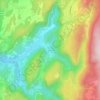
La Suisse

France > Auvergne-Rhône-Alpes > Ain > Cerdon

Average elevation: 546 m

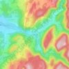
Pont de Préau

France > Auvergne-Rhône-Alpes > Ain > Cerdon

Average elevation: 439 m

Gear up for your next adventure:

🔦LED Headlamp - Hands-free lighting for early morning starts or late finishes
🛰️Satellite Messenger - Emergency communication for areas with no cell service
🥘Camping Cookware Set - Compact nesting pots and pans for trail cooking
🐕Hiking Dog Pack - Let your canine companion carry their own water and food
🧥Fleece Jacket - Warm and lightweight jacket for layering

As an Amazon Associate, this site earns from qualifying purchases at no extra cost to you.