Geolocate

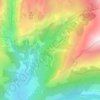
Termignon topographic maps

Click on a map to view its topography, its elevation and its terrain.

Le Suffet

France > Auvergne-Rhône-Alpes > Savoie > Val-Cenis > Termignon

Average elevation: 1,916 m

About this place

Gear up for your next adventure:

🦟Insect Repellent - Keep mosquitoes and black flies away in wooded areas
🔥Emergency Fire Starter - Reliable ignition source for all weather conditions
🧴Bear Spray Holster - Quick-access carry for essential Canadian wilderness safety
🧥Softshell Jacket - Windproof and breathable jacket for hiking
⛺Lightweight Backpacking Tent - Compact tent for efficient hiking trips

As an Amazon Associate, this site earns from qualifying purchases at no extra cost to you.