Geolocate

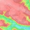
Saint-Forget topographic maps

Click on a map to view its topography, its elevation and its terrain.

Le Mesnil-Sevin

France > Île-de-France > Yvelines > Saint-Forget

Average elevation: 145 m

Gear up for your next adventure:

🧳Compression Sacks - Maximize space in your backpack by shrinking gear
🧤Thermal Hiking Gloves - Grip-enhanced gloves for cold-weather altitude trekking
🎒Fully Waterproof Backpack - Total protection for photography gear and electronics
⛺Family Camping Tent - Spacious tent suitable for family camping trips
🧤Insulated Winter Gloves - Heavy-duty protection for sub-zero Canadian adventures

As an Amazon Associate, this site earns from qualifying purchases at no extra cost to you.