Geolocate

Lumeng topographic maps

Click on a map to view its topography, its elevation and its terrain.
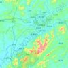
Jingdezhen

China > Jiangxi > Lumeng

Jingdezhen is situated in the north-east of Jiangxi and borders on Anhui; the city center area is located in the north-east of the Poyang Lake Plain. Its area is 5,256 km2 (2,029 sq mi).[10] The highest point is 1,618 m (5,308 ft), with plains on the southern part having an average altitude of 200 m (660 ft).

Average elevation: 100 m

Gear up for your next adventure:

🥾Approach Shoes - Shoes designed for climbing approaches and rugged trails
🔭Compact Binoculars - Lightweight optics for scouting trails and wildlife
🏕️Camping Hammock - Integrated protection for sleeping between trees
🦌Outdoor Trail Camera - Monitor wildlife activity near your favorite spots
🚑Survival Whistle - Signal for help across long distances in mountains

As an Amazon Associate, this site earns from qualifying purchases at no extra cost to you.