Geolocate

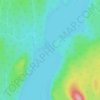
Lac-Croche topographic maps

Click on a map to view its topography, its elevation and its terrain.

Lac Saint-Henri

Canada > Quebec > La Jacques-Cartier > Lac-Croche

Average elevation: 448 m

Gear up for your next adventure:

🧰Emergency Multi-Tool - Compact multi-tool for outdoor survival
🎒Hiking Backpack - Lightweight and ergonomic backpacks for day hikes or multi-day treks
🧥Thermal Fleece Jacket - Versatile insulation for changing mountain temperatures
🌬️Windproof Camp Stove - Efficient cooking even on exposed mountain peaks
🦶Anti-Blister Balm - Prevents friction and hotspots during long ascents

As an Amazon Associate, this site earns from qualifying purchases at no extra cost to you.