Geolocate

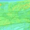
Miller topographic maps

Click on a map to view its topography, its elevation and its terrain.

Miller

United States > Indiana > Lake County > Gary > Miller

Average elevation: 186 m

Gear up for your next adventure:

🧦Merino Wool Socks - Moisture-wicking comfort for long-distance hiking
💧Filtered Water Bottle - Safe drinking water on the go
🥤Collapsible Travel Cup - Saves space and weight in your mess kit
💡LED Camping Lantern - Illuminate your campsite with long-lasting lanterns
🏃Hydration Running Vest - Carry water and maps close to your body for speed

As an Amazon Associate, this site earns from qualifying purchases at no extra cost to you.