Geolocate

Lacave topographic maps

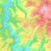
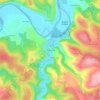
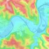
Click on a map to view its topography, its elevation and its terrain.

Canteloube

France > Occitanie > Lot > Lacave

Average elevation: 225 m

Les Bertoux

France > Occitanie > Lot > Lacave

Average elevation: 181 m

Le Bougayrou

France > Occitanie > Lot > Lacave

Average elevation: 165 m

Meyraguet

France > Occitanie > Lot > Lacave

Average elevation: 163 m

Gear up for your next adventure:

🧥Waterproof Pants - Keep dry during rainy hiking conditions
☕Camping Coffee Maker - Brew fresh coffee anywhere on the topographic map
🎒Backpack Rain Cover - External shield to keep your entire pack dry
🧴First Aid Kit - Essential first aid supplies for outdoor emergencies
🔋Solar Power Bank - Keep your GPS and devices charged during long outdoor trips

As an Amazon Associate, this site earns from qualifying purchases at no extra cost to you.