Japan topographic maps
Click on a map to view its topography, its elevation and its terrain.
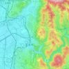
Tokyo
The mainland portion of Tokyo lies northwest of Tokyo Bay and measures about 90 km (56 mi) east to west and 25 km (16 mi) north to south. The average elevation in Tokyo is 40 m (131 ft). Chiba Prefecture borders it to the east, Yamanashi to the west, Kanagawa to the south, and Saitama to the north. Mainland…
Average elevation: 39 m


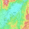
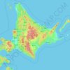
Hokkaido
Japan > Hokkaidō Region > Ashoro
Japan's coldest region, Hokkaido has relatively cool summers and icy/snowy winters. Most of the island falls in the humid continental climate zone with Köppen climate classification Dfb (hemiboreal) in most areas but Dfa (hot summer humid continental) in some inland lowlands. The average August temperature…
Average elevation: 98 m
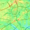


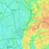
Matsudo
Matsudo is located in the far northwestern corner of Chiba Prefecture, about 20 to 30 kilometers from the prefectural capital at Chiba and 10 to 20 kilometers from downtown Tokyo. The western border of the city is the Edo River, which flows from north to south, and most of the city is on an alluvial plain with…
Average elevation: 13 m
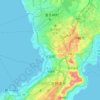
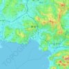
Kamakura
The Kamakura shogunate era is called by historians the Kamakura period and, although its end is clearly set (Siege of Kamakura (1333)), its beginning is not. Different historians put Kamakura's beginning at a different point in time within a range that goes from the establishment of Yoritomo's first military…
Average elevation: 33 m
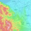
Sapporo
Sapporo is a city located in the southwest part of Ishikari Plain and the alluvial fan of the Toyohira River, a tributary stream of the Ishikari River. It is part of Ishikari Subprefecture. Roadways in the urban district are laid to make a grid plan. The western and southern parts of Sapporo are occupied by a…
Average elevation: 273 m
Mt. Fuji
Japan > Sunto County > Oyama
Mount Fuji (富士山, Fujisan, Japanese: [ɸɯꜜ(d)ʑisaɴ] ) is an active stratovolcano located on the Japanese island of Honshu, with a summit elevation of 3,776.24 m (12,389 ft 3 in). It is the tallest mountain in Japan, the second-highest volcano located on an island in Asia (after Mount Kerinci on the…
Average elevation: 3,261 m


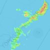
Okinawa Island
The Motobu Peninsula in the north has limestone layers and karst development. In the center and south is mainly a Ryukyu limestone layer and mudstone. The topography is flat, there are few hills over 100 m (328 ft) with very few rivers. The subtropical rains accelerate erosion so there are many drainages and…
Average elevation: 14 m