

Halmahera Timur topographic maps
Click on a map to view its topography, its elevation and its terrain.
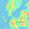
Aketajawe Lolobata National Park
Indonesia > North Maluku > Halmahera Timur
Threats to the national park are posed by illegal logging and mining. Between 1990 and 2003 forests declined in North Maluku from 86% to just under 70%, with much of it occurring in the lowlands (below 400m). As a result, species with large amounts of their range at low elevations were most strongly affected.
Average elevation: 161 m