Geolocate

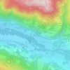
Verchaix topographic maps

Click on a map to view its topography, its elevation and its terrain.

La Tattaz

France > Auvergne-Rhône-Alpes > Upper Savoy > Verchaix

Average elevation: 926 m

Gear up for your next adventure:

🐕Hiking Dog Pack - Let your canine companion carry their own water and food
🧦Hiking Socks - Moisture-wicking and comfortable socks for long hikes
🥾Trail Hiking Boots - Supportive boots for rough trails
💡LED Camping Lantern - Illuminate your campsite with long-lasting lanterns
🚲Handlebar Phone Mount - View topographic-map.com live while cycling

As an Amazon Associate, this site earns from qualifying purchases at no extra cost to you.