Geolocate

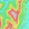
Haegen topographic maps

Click on a map to view its topography, its elevation and its terrain.

Rocher de Brotsch

France > Grand Est > Bas-Rhin > Haegen

Average elevation: 348 m

Winkelhoff

France > Grand Est > Bas-Rhin > Haegen

Average elevation: 294 m

Rocher JL Huck

France > Grand Est > Bas-Rhin > Haegen

Average elevation: 337 m

Le Brotschberg

France > Grand Est > Bas-Rhin > Haegen

Average elevation: 344 m

Gear up for your next adventure:

🥾Light Trekking Boots - Supportive boots for multi-day treks
🧭GPS Outdoor Watch - Smart watch for navigation and fitness tracking in nature
🛰️Satellite Messenger - Emergency communication for areas with no cell service
🏃Hydration Running Vest - Carry water and maps close to your body for speed
⛺Camping Essentials - All-in-one gear for a comfortable camping trip

As an Amazon Associate, this site earns from qualifying purchases at no extra cost to you.