Geolocate

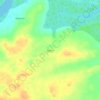
Itapera topographic maps

Click on a map to view its topography, its elevation and its terrain.

Itapera

Brasil > Maranhão > Icatu > Itapera

Average elevation: 18 m

Gear up for your next adventure:

👟Sport Hiking Sandals - Breathable footwear for water crossings and camp rest
🧭Orienteering Kit - Tools for map reading and navigation in the wild
🥾Trail Running Boots - Durable shoes designed for trail running
🧭GPS Handheld Device - Reliable GPS navigation for outdoor adventures
🌬️Windproof Camp Stove - Efficient cooking even on exposed mountain peaks

As an Amazon Associate, this site earns from qualifying purchases at no extra cost to you.