Geolocate

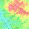
Flers topographic maps

Click on a map to view its topography, its elevation and its terrain.

Les Vallées

France > Normandie > Orne > Flers

Average elevation: 207 m

Montagnou

France > Normandie > Orne > Flers

Average elevation: 214 m

Les Basses Folletières

France > Normandie > Orne > Flers

Average elevation: 224 m

Château de Flers

France > Normandie > Orne > Flers

Average elevation: 200 m

La Fouquerie

France > Normandie > Orne > Flers

Average elevation: 226 m

Gear up for your next adventure:

🎒Hiking Backpack - Lightweight and ergonomic backpacks for day hikes or multi-day treks
🦶Anti-Blister Balm - Prevents friction and hotspots during long ascents
🧥Waterproof Hiking Jacket - Protect yourself from rain and wind while hiking
🏃Hydration Running Vest - Carry water and maps close to your body for speed
🥾Light Trekking Boots - Supportive boots for multi-day treks

As an Amazon Associate, this site earns from qualifying purchases at no extra cost to you.