Geolocate

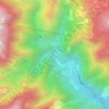
Baguio topographic maps

Click on a map to view its topography, its elevation and its terrain.

Bued River

Philippines > Benguet > Baguio

Average elevation: 1,185 m

Bued River

Philippines > Benguet > Baguio

Average elevation: 1,095 m

Gear up for your next adventure:

💡LED Headlamp - Hands-free illumination for night hiking and camping
🚲Handlebar Phone Mount - View topographic-map.com live while cycling
🔋Emergency Crank Radio - Weather alerts and power without needing batteries
🧣Merino Neck Gaiter - Protects against wind, sun, and cold at high altitudes
🥾Hiking Boots - Sturdy boots providing ankle support and traction on rugged trails

As an Amazon Associate, this site earns from qualifying purchases at no extra cost to you.