Geolocate

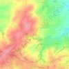
Deguilly topographic maps

Click on a map to view its topography, its elevation and its terrain.

Deguilly

France > Centre-Val de Loire > Cher > Préveranges > Deguilly

Average elevation: 445 m

Gear up for your next adventure:

💡LED Camping Lantern - Illuminate your campsite with long-lasting lanterns
🛶Waterproof Dry Bags - Keep electronics and clothes dry during river crossings
🕶️Polarized Sunglasses - Protect your eyes with durable polarized lenses
🔋Solar Power Bank - Keep your GPS and devices charged during long outdoor trips
🧦Hiking Liner Socks - Thin base layer to prevent friction and blisters

As an Amazon Associate, this site earns from qualifying purchases at no extra cost to you.