Geolocate

Kulm topographic maps

Click on a map to view its topography, its elevation and its terrain.
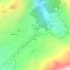
Col du Simplon

Suisse > Valais > Brigue > Simplon > Kulm

La distance routière de Brigue (altitude : 691 m) au col du Simplon est de 22 km (dénivelé : 1 317 m) ; du col à la frontière italienne, de 20 km ; de la frontière à Stresa, sur le lac Majeur (altitude : 200 m, soit un dénivelé de 1 808 m), de 64 km.

Average elevation: 2,082 m

Gear up for your next adventure:

🛏️Camping Sleeping Mat - Comfortable mats for sleeping outdoors
🧭Orienteering Kit - Tools for map reading and navigation in the wild
🔨Vehicle Emergency Tool - Safety tool for remote road trips to trailheads
🧢Hiking Hat - Sun-protective and breathable hats for long treks
🥾Trail Hiking Boots - Supportive boots for rough trails

As an Amazon Associate, this site earns from qualifying purchases at no extra cost to you.