Geolocate

Mainsat topographic maps

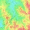
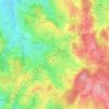
Click on a map to view its topography, its elevation and its terrain.

La Chirade

France > Nouvelle-Aquitaine > Creuse > Mainsat

Average elevation: 574 m

Le Mont

France > Nouvelle-Aquitaine > Creuse > Mainsat

Average elevation: 600 m

Vaurennes

France > Nouvelle-Aquitaine > Creuse > Mainsat

Average elevation: 560 m

Gear up for your next adventure:

🪜Heavy Duty Carabiners - Multi-use clips for securing gear to your backpack
🛶Kayak Accessories - Essential gear for safe and fun kayaking adventures
🥾Waterproof Hiking Boots - Essential footwear for rugged terrain and wet Canadian trails
🔦LED Headlamp - Hands-free lighting for early morning starts or late finishes
🧴Bear Spray Holster - Quick-access carry for essential Canadian wilderness safety

As an Amazon Associate, this site earns from qualifying purchases at no extra cost to you.