Geolocate

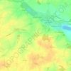
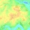
Saumeray topographic maps

Click on a map to view its topography, its elevation and its terrain.

Ludon

France > Centre-Val de Loire > Eure-et-Loir > Saumeray

Average elevation: 145 m

Gear up for your next adventure:

🔦LED Headlamp - Hands-free lighting for early morning starts or late finishes
🔨Vehicle Emergency Tool - Safety tool for remote road trips to trailheads
☕Camping Coffee Maker - Brew fresh coffee anywhere on the topographic map
🛏️Sleeping Bag - Warm and compact sleeping bags for outdoor camping
💧Filtered Water Bottle - Safe drinking water on the go

As an Amazon Associate, this site earns from qualifying purchases at no extra cost to you.