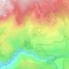
Font-Romeu-Odeillo-Via topographic maps
Click on a map to view its topography, its elevation and its terrain.

Font-Romeu
France > Occitanie > Pyrénées-Orientales > Font-Romeu-Odeillo-Via
Average elevation: 1,710 m

L'Ermitage
France > Occitanie > Pyrénées-Orientales > Font-Romeu-Odeillo-Via
Average elevation: 1,785 m

Via
France > Occitanie > Pyrénées-Orientales > Font-Romeu-Odeillo-Via
Le village de Via se situe à une altitude de 1 510 mètres.
Average elevation: 1,551 m