Canada topographic maps
Click on a map to view its topography, its elevation and its terrain.
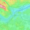
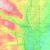

Adams Lake
Canada > British Columbia > Thompson-Nicola Regional District > Area O (Lower North Thompson)
According to one account, the lake is 63 kilometres (39 mi) long and 1.6 to 3.2 kilometres (1.0 to 2.0 mi) wide. The surface elevation is 404 metres (1,325 ft) above sea level. The mean depth of 299 metres (981 ft) and maximum depth of 457 metres (1,499 ft) make the second deepest lake in BC (next to Quesnel…
Average elevation: 1,177 m

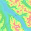
Maligne Lake
Canada > Alberta > Division No. 15
Wildlife is surprisingly abundant along this high altitude oligotrophic lake. Grizzly bear, black bear, mule deer, caribou, wolves, moose, and mountain sheep are some of the larger mammals that frequent the lake area during the summer season. Bald eagles, golden eagles and osprey also frequent the area and…
Average elevation: 2,125 m
Columbia Icefield
Canada > Alberta > Division No. 15 > Area A (Kicking Horse/Kinbasket Lake)
Columbia Icefield has a alpine climate (Köppen: ETf), because the weather station is located at an altitude of 1,981.20 m (6,500 ft). The average annual temperature is −2.1 °C (28.2 °F). The month of July is the warmest with an average temperature of 9.1 °C (48.38 °F).
Average elevation: 2,484 m
Newmarket
Canada > Ontario > York Region
Newmarket's geographical coordinates are 44.05°N, 79.46°W, and its elevation above sea level is 252 m. It has an area of 38.33 km2. The town is bounded on the south by Aurora, on the west by King, on the north by East Gwillimbury and on the east by Whitchurch–Stouffville.
Average elevation: 270 m


Bow Lake
Canada > Alberta > Division No. 15
Bow Lake is a small lake in western Alberta, Canada. It is located on the Bow River, in the Canadian Rockies, at an altitude of 1920 m.
Average elevation: 2,165 m

Nungesser Lake
Canada > Ontario > Kenora District > Unorganized Kenora District
Average elevation: 412 m

Waterton Lakes National Park
Canada > Alberta > Division No. 3
Operated by Parks Canada, Waterton is open all year, but the main tourist season is during July and August. The only commercial facilities available within the park are located at the Waterton Park townsite. This park ranges in elevation from 1,290 metres (4,232 ft) at the townsite to 2,910 m (9,547 ft) at…
Average elevation: 1,778 m


Mount Celeste
Canada > British Columbia > Alberni-Clayoquot Regional District > Area D (Sproat Lake)
Average elevation: 1,643 m

Garibaldi Provincial Park
Canada > British Columbia > Squamish-Lillooet Regional District
There are over 150 glaciers in the park, including the Garibaldi Névé and Mamquam icefields. The highest peak in Garibaldi Park is Wedge Mountain, at an elevation of 2,891 metres (9,485 ft). It also includes volcanic features such as an andesite tuya known as The Table, a cinder cone known as the Opal Cone,…
Average elevation: 1,318 m
Upsala
Canada > Ontario > Thunder Bay District > Unorganized Thunder Bay District
Average elevation: 487 m
Harrison Lake
Canada > British Columbia > Fraser Valley Regional District > Area C (Sasquatch Country)
Average elevation: 815 m


Lillooet Lake
Canada > British Columbia > Squamish-Lillooet Regional District > Area C (Pemberton Valley/Mount Currie/D'Arcy)
Average elevation: 1,177 m





Kamloops
Canada > British Columbia > Thompson-Nicola Regional District > Kamloops
Average elevation: 875 m





Medicine Lake
Canada > Alberta > Division No. 15
Wildlife is surprisingly abundant along this high altitude lake. Grizzly bear, black bear, mule deer, caribou, wolves, moose and mountain sheep are some of the larger mammals that frequent the lake area during the summer season. Bald eagles, and osprey also frequent the area and live off the fish populations.
Average elevation: 1,681 m


Miocene
Canada > British Columbia > Cariboo Regional District > Area F (Horsefly/Likely/150 Mile House)
Average elevation: 1,009 m


Wasa Lake
Canada > British Columbia > Regional District of East Kootenay > Area E (Saint Mary/Skookumchuck) > Wasa
Average elevation: 793 m

Cortes Island
Canada > British Columbia > Strathcona Regional District > Area C (Cortes Island)
Average elevation: 72 m




Avonmore
Canada > Ontario > Stormont, Dundas and Glengarry Counties > North Stormont
Average elevation: 95 m



Radium Hot Springs
Canada > British Columbia > Regional District of East Kootenay
Average elevation: 912 m




Baldonnel
Canada > British Columbia > Peace River Regional District > Area C (Old Fort/Charlie Lake)
Average elevation: 672 m


Maligne Canyon
Canada > Alberta > Division No. 15 > Municipality of Jasper
While visually striking and unusual, slot canyons are a common occurrence within the northern Rocky Mountains. These canyons show the characteristics of karst topography and are common in this region due to the easily soluble nature of the limestone. Flowing out of Medicine Lake, the Maligne River flows about…
Average elevation: 1,134 m

London
London has a humid continental climate (Köppen Dfb), though due to its downwind location relative to Lake Huron and elevation changes across the city, it is virtually on the Dfa/Dfb (hot summer) boundary favouring the former climate zone to the southwest of the confluence of the South and North Thames Rivers,…
Average elevation: 269 m
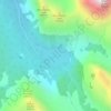
Lake O'Hara
Canada > British Columbia > Columbia-Shuswap Regional District > Area A (Kicking Horse/Kinbasket Lake)
Lake O'Hara is a lake at an elevation of 2,020 metres (6,630 ft) in the alpine area of Yoho National Park, in the province of British Columbia, on the western side of the Great Divide with the province of Alberta and Banff National Park to the east. The lake and the valley are accessible through a bus service…
Average elevation: 2,276 m


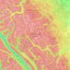

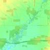


Langdale
Canada > British Columbia > Sunshine Coast Regional District > Area F (West Howe Sound)
Average elevation: 55 m


Yellowhead Island
Canada > Ontario > Muskoka District > Georgian Bay Township
Average elevation: 182 m


Scotch Creek
Canada > British Columbia > Columbia-Shuswap Regional District > Area F (Scotch Creek/Seymour Arm)
Average elevation: 1,125 m


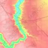
Lethbridge
Its high elevation of 929 m (3,048 ft) and close proximity to the Rocky Mountains provides Lethbridge with cooler summers than other locations in the Canadian Prairies. These factors protect the city from strong northwest and southwest winds and contribute to frequent chinook winds during the winter.…
Average elevation: 907 m


Houston
Canada > British Columbia > Regional District of Bulkley-Nechako
The Houston Hikers' Society provides website where trail information, maps, photos and driving directions can be accessed. The Morice Mountain Nordic Ski Club is a volunteer non-profit society. The MMNSC is responsible for all developments and trail grooming as well as maintenance of the facilities, and for…
Average elevation: 728 m