Geolocate

Laguna topographic maps

Click on a map to view its topography, its elevation and its terrain.
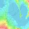
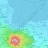
Laguna de Bay

Philippines > Laguna

Laguna de Bay (Spanish for "Lagoon/Lake of Bay"; Tagalog: Lawa ng Bay, [baɪ]), also known as Laguna Lake, is the largest lake in the Philippines. It is located southeast of Metro Manila, between the provinces of Laguna to the south and Rizal to the north. A freshwater lake, it has a surface area of 911–949…

Average elevation: 62 m
San Pedro

Philippines > Laguna > San Pedro > San Pedro

Average elevation: 51 m

Dita

Philippines > Laguna > Liliw

Average elevation: 34 m

Siniloan

Philippines > Laguna

Buruwisan falls is located in Siniloan Laguna which is around eighty kilometers east of Manila. To get there we had to cross the long winding roads of Teresa and Bugarin to Mabitac. By public transport Take UV express vans bound to Tanay market in Starmall-Shaw terminal (P70). Then in Tanay market, ride a…

Average elevation: 120 m
Los Baños

Philippines > Laguna

Average elevation: 98 m

Turbina

Philippines > Laguna > Calamba

Average elevation: 81 m

Dila

Philippines > Laguna > Bay

Average elevation: 7 m

Malitlit

Philippines > Laguna > Santa Rosa

Average elevation: 32 m

Calamba

Philippines > Laguna > Calamba > Calamba

Average elevation: 100 m

About this place

 •  •  •  •  •

Gear up for your next adventure:

🧥Waterproof Jacket - Lightweight rain jackets for hiking and outdoor activities
🕶️Polarized Sunglasses - Protect your eyes with durable polarized lenses
🪑Ultralight Camping Stool - Compact seating for rest stops during long hikes
🧴Outdoor Sunscreen - High SPF protection for high-altitude UV exposure
👟Leg Gaiters - Keep debris, mud, and snow out of your boots

As an Amazon Associate, this site earns from qualifying purchases at no extra cost to you.