Geolocate

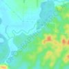
FELDA Pasak topographic maps

Click on a map to view its topography, its elevation and its terrain.

Sungai Seluyut

Malaysia > Johor > FELDA Pasak

Average elevation: 13 m

Gear up for your next adventure:

🪑Ultralight Camping Stool - Compact seating for rest stops during long hikes
🧭Orienteering Kit - Tools for map reading and navigation in the wild
🌬️Windproof Camp Stove - Efficient cooking even on exposed mountain peaks
🧥Ultralight Puffy Jacket - Maximum warmth that packs down to the size of an orange
💡Portable Camping Lamp - Rechargeable lamp for campsite lighting

As an Amazon Associate, this site earns from qualifying purchases at no extra cost to you.