Click on a map to view its topography, its elevation and its terrain.
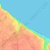
France > Normandy > Calvados > Vierville-sur-Mer
Average elevation: 21 m
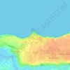
France > Normandy > Calvados > Cricqueville-en-Bessin > Le Pont du Hable
Average elevation: 12 m
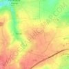
France > Normandy > Calvados
Average elevation: 67 m
Average elevation: 27 m
Average elevation: 161 m
Average elevation: 108 m
Average elevation: 56 m
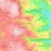
France > Normandy > Calvados > Condé-en-Normandie
Average elevation: 130 m
Average elevation: 25 m
Average elevation: 110 m
Average elevation: 39 m
France > Normandy > Calvados > Tessel
Average elevation: 106 m
Average elevation: 18 m
Average elevation: 31 m
Average elevation: 180 m
As an Amazon Associate, this site earns from qualifying purchases at no extra cost to you.