Geolocate

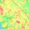
Guidel topographic maps

Click on a map to view its topography, its elevation and its terrain.

Guidel

France > Bretagne > Morbihan > Guidel > Guidel

L'intérieur du finage communal forme pour l'essentiel un plateau situé vers une cinquantaine de mètres d'altitude, culminant à 64 mètres d'altitude à Kermémé près de la limite orientale de la commune. Sa partie nord-est est parcourue par un affluent de la Scave (elle-même affluent de rive droite du…

Average elevation: 34 m
Précar

France > Bretagne > Morbihan > Guidel > Précar

Average elevation: 27 m

Keroual

France > Bretagne > Morbihan > Guidel > Keroual

Average elevation: 42 m

Le Stanco

France > Bretagne > Morbihan > Guidel > Le Stanco

Average elevation: 39 m

Le Palméro

France > Bretagne > Morbihan > Guidel > Le Palméro

Average elevation: 38 m

About this place

 •  •  •  •

Gear up for your next adventure:

🥾Light Hiking Boots - Lightweight and comfortable boots for day hikes
🥾Light Trekking Boots - Supportive boots for multi-day treks
⛺Backpacking Tent - Lightweight tent for long-distance hiking trips
🧭GPS Outdoor Watch - Smart watch for navigation and fitness tracking in nature
🦯Trekking Poles - Reduced impact on joints for steep topographic climbs

As an Amazon Associate, this site earns from qualifying purchases at no extra cost to you.