Geolocate

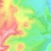
Lys topographic maps

Click on a map to view its topography, its elevation and its terrain.

La Coudraye

France > Bourgogne-Franche-Comté > Nièvre > Lys

Average elevation: 233 m

Gear up for your next adventure:

⛺Camping Groundsheet - Protect your tent from moisture and dirt
🥾Light Trekking Boots - Supportive boots for multi-day treks
🌡️Emergency Mylar Blankets - Compact thermal protection for unexpected nights outdoors
🧥Thermal Layer - Insulating layer for cold outdoor conditions
👟Trail Running Shoes - Agile footwear for fast-paced topographic exploration

As an Amazon Associate, this site earns from qualifying purchases at no extra cost to you.