Geolocate

Porter County topographic maps

Click on a map to view its topography, its elevation and its terrain.
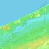
Suman

United States > Indiana > Porter County

Average elevation: 242 m

Burns Harbor

United States > Indiana > Porter County

Average elevation: 189 m

Porter

United States > Indiana > Porter County

Average elevation: 193 m

South Haven

United States > Indiana > Porter County

Average elevation: 200 m

Hebron

United States > Indiana > Porter County

Average elevation: 213 m

Kouts

United States > Indiana > Porter County

Average elevation: 208 m

Indiana Dunes National Park

United States > Indiana > Porter County > Portage

Miller Woods is located in Miller Beach, Indiana. It is accessed through the Paul H. Douglas Center for Environmental Education on Lake Street. The area is dominated by ridge and swale topography. the ridges or swells are beach and dune sand. They date from the post Glacial Lake Nipissing period some 3000…

Average elevation: 188 m

Chesterton

United States > Indiana > Porter County

Average elevation: 200 m

Ogden Dunes

United States > Indiana > Porter County

Average elevation: 184 m

Portage

United States > Indiana > Porter County

Average elevation: 190 m

Valparaiso

United States > Indiana > Porter County

Average elevation: 235 m

Beverly Shores

United States > Indiana > Porter County

Average elevation: 186 m

Morgan Park

United States > Indiana > Porter County > Chesterton

Average elevation: 197 m

About this place

 •  •

Gear up for your next adventure:

🔭Compact Monocular - One-handed bird watching and trail spotting
🦯Trekking Poles - Reduced impact on joints for steep topographic climbs
🥾Approach Boots - Comfortable boots for hiking and climbing approaches
🧣Evaporative Cooling Towel - Beat the heat during intense summer climbs
🎒Hiking Daypack - Lightweight and durable backpacks for day trips and excursions

As an Amazon Associate, this site earns from qualifying purchases at no extra cost to you.