Geolocate

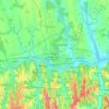
Somogy topographic maps

Click on a map to view its topography, its elevation and its terrain.

Igal

Hungary > Transdanubia > Somogy

Average elevation: 196 m

Táska

Hungary > Transdanubia > Somogy

Average elevation: 115 m

Szólád

Hungary > Transdanubia > Somogy

Average elevation: 161 m

Zamárdi

Hungary > Transdanubia > Somogy

Average elevation: 126 m

Kaposvár

Hungary > Transdanubia > Somogy

Average elevation: 162 m

Gear up for your next adventure:

🧢Outdoor Visor - Breathable visor for sunny hikes
🔪Outdoor Multitool - Versatile tool for repairs and food prep in the wild
💧Hydration Pack - Hands-free hydration system for long hikes
👟Leg Gaiters - Keep debris, mud, and snow out of your boots
🔦LED Flashlight - Powerful and long-lasting flashlight for camping and emergencies

As an Amazon Associate, this site earns from qualifying purchases at no extra cost to you.