Geolocate

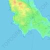
Port Maria topographic maps

Click on a map to view its topography, its elevation and its terrain.

Le Manémeur

France > Bretagne > Morbihan > Port Maria

Average elevation: 6 m

Gear up for your next adventure:

⛺Backpacking Tent - Lightweight tent for long-distance hiking trips
🔥Emergency Fire Starter - Reliable ignition source for all weather conditions
🦶Anti-Blister Balm - Prevents friction and hotspots during long ascents
🚲Handlebar Phone Mount - View topographic-map.com live while cycling
🥾Durable Hiking Shoes - Long-lasting shoes for frequent hiking

As an Amazon Associate, this site earns from qualifying purchases at no extra cost to you.