Geolocate

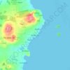
Mata Utu topographic maps

Click on a map to view its topography, its elevation and its terrain.

Mata Utu

France > Wallis and Futuna > Uvea > Mata Utu

Average elevation: 25 m

Gear up for your next adventure:

👟Sport Hiking Sandals - Breathable footwear for water crossings and camp rest
🥫Freeze-Dried Meals - Lightweight, high-calorie nutrition for multi-day treks
☕Camping Coffee Maker - Brew fresh coffee anywhere on the topographic map
🧭Orienteering Kit - Tools for map reading and navigation in the wild
🥾Trail Hiking Boots - Supportive boots for rough trails

As an Amazon Associate, this site earns from qualifying purchases at no extra cost to you.