Geolocate

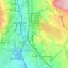
Shuttleworth topographic maps

Click on a map to view its topography, its elevation and its terrain.

Park

United Kingdom > England > Bury > Shuttleworth

Average elevation: 204 m

Gear up for your next adventure:

🛶Waterproof Dry Bags - Keep electronics and clothes dry during river crossings
🛶Kayak Dry Bag - Waterproof storage for kayaking adventures
🛰️Satellite Messenger - Emergency communication for areas with no cell service
💡Portable Camping Lamp - Rechargeable lamp for campsite lighting
🧭Orienteering Kit - Tools for map reading and navigation in the wild

As an Amazon Associate, this site earns from qualifying purchases at no extra cost to you.