Geolocate

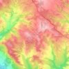
Piera topographic maps

Click on a map to view its topography, its elevation and its terrain.

Can Claramunt

España > Cataluña > Anoia > Piera

Average elevation: 297 m

Gear up for your next adventure:

🧥Softshell Jacket - Windproof and breathable jacket for hiking
💧Filtered Water Bottle - Safe drinking water on the go
🗺️Topographic Maps - Detailed maps to explore trails, mountains, and wilderness areas
💡LED Camping Lantern - Illuminate your campsite with long-lasting lanterns
🧢Hiking Sun Hat - Wide-brimmed protection for exposed mountain ridges

As an Amazon Associate, this site earns from qualifying purchases at no extra cost to you.