Geolocate

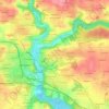
Lichern topographic maps

Click on a map to view its topography, its elevation and its terrain.

Lichern

France > Bretagne > Finistère > Quimperlé > Lichern

Average elevation: 52 m

Gear up for your next adventure:

🧭GPS Handheld Device - Reliable GPS navigation for outdoor adventures
🥾Trail Hiking Socks - Comfortable socks to prevent blisters and fatigue
🗺️Topographic Maps - Detailed maps to explore trails, mountains, and wilderness areas
💧Collapsible Water Bottle - Space-saving water bottle for outdoor activities
🔭Compact Monocular - One-handed bird watching and trail spotting

As an Amazon Associate, this site earns from qualifying purchases at no extra cost to you.