Geolocate

Chiusa topographic maps

Click on a map to view its topography, its elevation and its terrain.
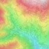
Lazfons

Italia > Trentino-Alto Adige > Bolzano > Chiusa

Average elevation: 1,231 m

Gear up for your next adventure:

🥾Trekking Poles - Adjustable trekking poles to reduce knee stress and improve stability
🧤Thermal Hiking Gloves - Grip-enhanced gloves for cold-weather altitude trekking
🛶Kayak Dry Bag - Waterproof storage for kayaking adventures
🚲MTB Frame Bag - Carry tools and maps directly on your bicycle frame
🥾Trail Hiking Shoes - Durable shoes designed for rugged trails

As an Amazon Associate, this site earns from qualifying purchases at no extra cost to you.