
Falmouth topographic map
Interactive map
Click on the map to display elevation.
About this map
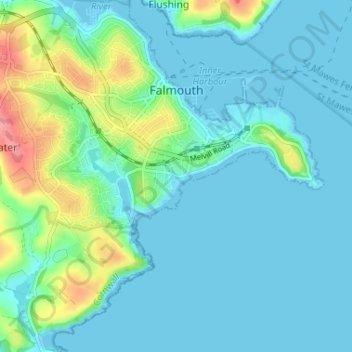
Name: Falmouth topographic map, elevation, terrain.
Location: Falmouth, Cornwall, England, United Kingdom (50.12430 -5.10639 50.16590 -5.04154)
Average elevation: 17 m
Minimum elevation: -1 m
Maximum elevation: 86 m
Other topographic maps
Click on a map to view its topography, its elevation and its terrain.