
Walkerton topographic map
Interactive map
Click on the map to display elevation.
About this map
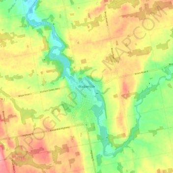
Name: Walkerton topographic map, elevation, terrain.
Location: Walkerton, Brockton, Bruce County, Ontario, N0G 2V0, Canada (44.09319 -81.18859 44.17319 -81.10859)
Average elevation: 286 m
Minimum elevation: 237 m
Maximum elevation: 334 m
Bruce County trails, hiking, mountain biking, running and outdoor activities
Other topographic maps
Click on a map to view its topography, its elevation and its terrain.