
Lachute topographic map
Interactive map
Click on the map to display elevation.
About this map
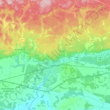
Name: Lachute topographic map, elevation, terrain.
Location: Lachute, Argenteuil, Laurentides, Quebec, Canada (45.59900 -74.37927 45.73962 -74.20395)
Average elevation: 127 m
Minimum elevation: 32 m
Maximum elevation: 298 m
Argenteuil trails, hiking, mountain biking, running and outdoor activities
Other topographic maps
Click on a map to view its topography, its elevation and its terrain.
Pointe-au-Chêne
Canada > Quebec > Argenteuil > Grenville-sur-la-Rouge > Pointe-au-Chêne
Average elevation: 94 m