
Lakefield topographic map
Click on the map to display elevation.
About this map
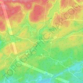
Name: Lakefield topographic map, elevation, terrain.
Location: Lakefield, Gore, Argenteuil, Laurentides, Quebec, Canada (45.73113 -74.27625 45.77113 -74.23625)
Average elevation: 263 m
Minimum elevation: 198 m
Maximum elevation: 327 m
Argenteuil trails, hiking, mountain biking, running and outdoor activities