
Town of Cardston topographic map
Interactive map
Click on the map to display elevation.
About this map
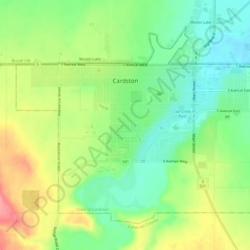
Name: Town of Cardston topographic map, elevation, terrain.
Location: Town of Cardston, Cardston (town), Alberta, Canada (49.17995 -113.34018 49.20772 -113.28623)
Average elevation: 1,166 m
Minimum elevation: 1,126 m
Maximum elevation: 1,223 m