
Town of Kentville topographic map
Interactive map
Click on the map to display elevation.
About this map
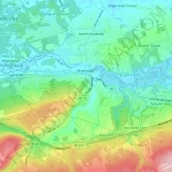
Name: Town of Kentville topographic map, elevation, terrain.
Location: Town of Kentville, Kings County, Nova Scotia, Canada (45.05544 -64.56587 45.09002 -64.47375)
Average elevation: 64 m
Minimum elevation: 1 m
Maximum elevation: 216 m
Kings County trails, hiking, mountain biking, running and outdoor activities