
Ord River topographic map
Interactive map
Click on the map to display elevation.
About this map
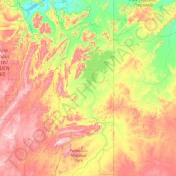
Name: Ord River topographic map, elevation, terrain.
Location: Ord River, Western Australia, 6743, Australia (-17.72190 127.57663 -15.47849 128.90945)
Average elevation: 244 m
Minimum elevation: 0 m
Maximum elevation: 733 m
Other topographic maps
Click on a map to view its topography, its elevation and its terrain.