
Fortress of Louisbourg topographic map
Interactive map
Click on the map to display elevation.
About this map
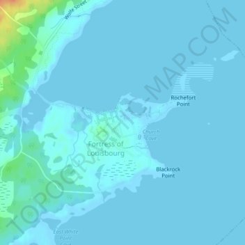
Name: Fortress of Louisbourg topographic map, elevation, terrain.
Average elevation: 3 m
Minimum elevation: -2 m
Maximum elevation: 40 m
Nova Scotia trails, hiking, mountain biking, running and outdoor activities
Other topographic maps
Click on a map to view its topography, its elevation and its terrain.
Twelve Mile Lake
Canada > Nova Scotia > Fortress of Louisbourg National Historic Park
Average elevation: 91 m