
Republic of the Congo topographic map
Interactive map
Click on the map to display elevation.
About this map
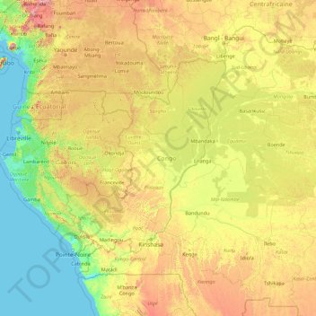
Name: Republic of the Congo topographic map, elevation, terrain.
Location: Republic of the Congo, Congo-Brazzaville (-7.72643 8.64192 6.27357 22.64192)
Average elevation: 429 m
Minimum elevation: 0 m
Maximum elevation: 3,328 m
Other topographic maps
Click on a map to view its topography, its elevation and its terrain.
Mbomo
Congo-Brazzaville > Cuvette-Ouest Department
Mbomo, Cuvette-Ouest Department, Congo-Brazzaville
Average elevation: 483 m
Cuvette-Ouest Department
Cuvette-Ouest Department, Congo-Brazzaville
Average elevation: 453 m