
Taylor Lake topographic map
Interactive map
Click on the map to display elevation.
About this map
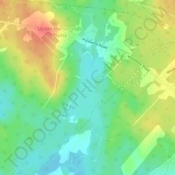
Name: Taylor Lake topographic map, elevation, terrain.
Average elevation: 128 m
Minimum elevation: 103 m
Maximum elevation: 164 m
Other topographic maps
Click on a map to view its topography, its elevation and its terrain.
Pockwock Lake
Canada > Nova Scotia > Upper Hammonds Plains
Pockwock Lake, Pockwock Road, Upper Hammonds Plains, Halifax Regional Municipality, Halifax County, Nova Scotia, B4B 1N8, Canada
Average elevation: 133 m
Little Pockwock Lake
Canada > Nova Scotia > Upper Hammonds Plains
Little Pockwock Lake, Pockwock Road, Upper Hammonds Plains, Halifax Regional Municipality, Halifax County, Nova Scotia, B4B 1N8, Canada
Average elevation: 129 m