
Friday Harbour Nature Preserve topographic map
Interactive map
Click on the map to display elevation.
About this map
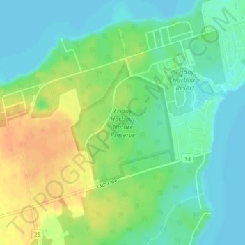
Name: Friday Harbour Nature Preserve topographic map, elevation, terrain.
Average elevation: 230 m
Minimum elevation: 216 m
Maximum elevation: 251 m
Other topographic maps
Click on a map to view its topography, its elevation and its terrain.
Churchill
Canada > Ontario > Simcoe County > Innisfil
Churchill, Innisfil, Simcoe County, Central Ontario, Ontario, L0L 1W0, Canada
Average elevation: 262 m