
Horsham topographic map
Interactive map
Click on the map to display elevation.
About this map
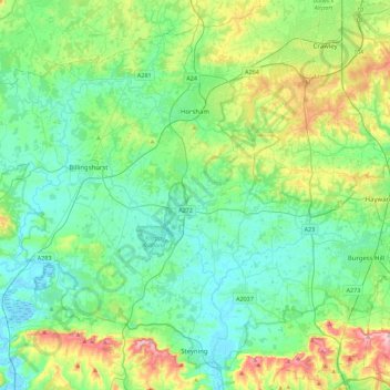
Name: Horsham topographic map, elevation, terrain.
Location: Horsham, West Sussex, England, United Kingdom (50.86216 -0.56904 51.14312 -0.20003)
Average elevation: 59 m
Minimum elevation: -2 m
Maximum elevation: 247 m
Other topographic maps
Click on a map to view its topography, its elevation and its terrain.