
Beauchene Island topographic map
Interactive map
Click on the map to display elevation.
About this map
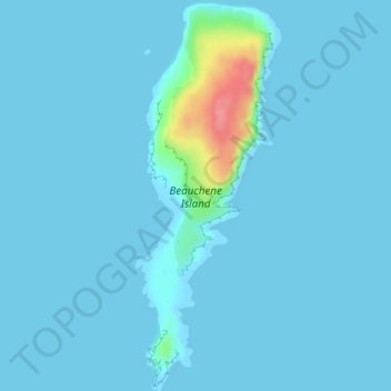
Name: Beauchene Island topographic map, elevation, terrain.
Location: Beauchene Island, Falkland Islands (-52.91911 -59.19386 -52.89111 -59.17655)
Average elevation: 6 m
Minimum elevation: -2 m
Maximum elevation: 83 m
Other topographic maps
Click on a map to view its topography, its elevation and its terrain.