
Mbanika topographic map
Interactive map
Click on the map to display elevation.
About this map
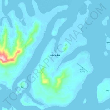
Name: Mbanika topographic map, elevation, terrain.
Location: Mbanika, Central Province, Solomon Islands (-9.13750 159.15333 -9.02325 159.23104)
Average elevation: 22 m
Minimum elevation: -8 m
Maximum elevation: 414 m
Other topographic maps
Click on a map to view its topography, its elevation and its terrain.
Central Province
Solomon Islands > Central Province
Central Province, Solomon Islands
Average elevation: 23 m
Nggela Sule
Solomon Islands > Central Province
Nggela Sule, Central Province, Solomon Islands
Average elevation: 33 m
Pavuvu
Solomon Islands > Central Province
Pavuvu, Central Province, Solomon Islands
Average elevation: 26 m