
Yangon City topographic map
Interactive map
Click on the map to display elevation.
About this map
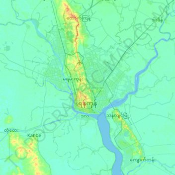
Name: Yangon City topographic map, elevation, terrain.
Location: Yangon City, Yangon, Myanmar (16.59197 95.99476 17.09075 96.36881)
Average elevation: 6 m
Minimum elevation: -2 m
Maximum elevation: 64 m
Other topographic maps
Click on a map to view its topography, its elevation and its terrain.