
Edson topographic map
Click on the map to display elevation.
Edson
Due to Edson's high elevation, the community experiences a subarctic climate (Köppen climate classification Dfc). The highest temperature ever recorded in Edson was 37.2 °C (99 °F) on 2 July 1924. The coldest temperature ever recorded was −48.3 °C (−55 °F) on 22 January 1943, and 14 January 1950.
About this map
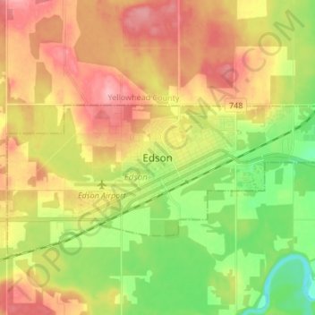
Name: Edson topographic map, elevation, terrain.
Location: Edson, Town of Edson, Alberta, T7E 1H7, Canada (53.54587 -116.48285 53.62587 -116.40285)
Average elevation: 928 m
Minimum elevation: 868 m
Maximum elevation: 988 m
Alberta trails, hiking, mountain biking, running and outdoor activities