
Kythira topographic map
Interactive map
Click on the map to display elevation.
About this map
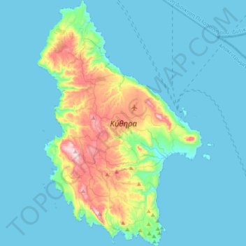
Name: Kythira topographic map, elevation, terrain.
Location: Kythira, Regional Unit of Islands, Attica, Greece (36.13024 22.89101 36.38578 23.10492)
Average elevation: 75 m
Minimum elevation: 0 m
Maximum elevation: 502 m
Other topographic maps
Click on a map to view its topography, its elevation and its terrain.